

Auto Tour on Route 899 -The Always-Green “Highway of the North”
By: Amnon Goffer, a certified tour guide.
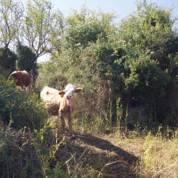
The winding road of Route 899, stretches from the Blue ocean to the Green upper groves of the Galilee, taking travelers on an intoxicating journey of colors, flavors, places and people that seem as if scattered by an artist-hand over the farthest northern corners of the Israeli map. An excursion to the verdant groves and landscapes of the Galilee where travelers will occasionally find a way to taste the multitude of additional attractions the area has to offer.
Contact and address
נווטו אלינו
מידע נוסף
The Sea and the Rock
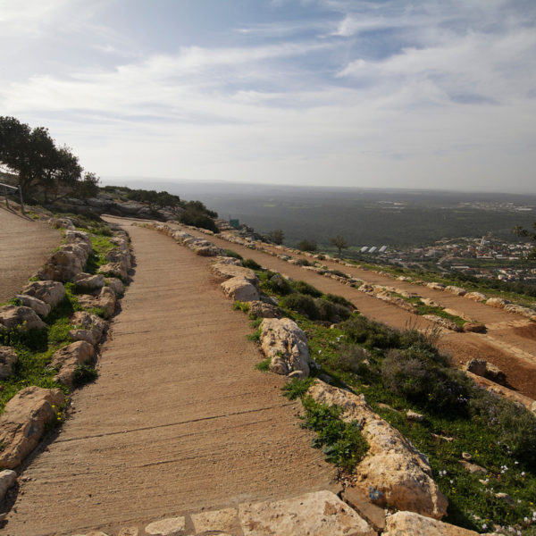
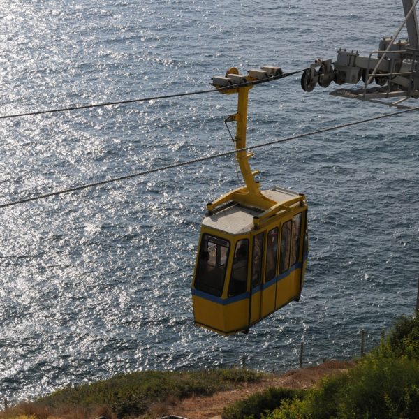
The tour begins at the site of Rosh Hanikrah – a look southwards to the coastline below reveals sandy coves while further still to the south observers can see Nahariya, Acre and even Haifa and the Bay, sending its long tongue into the ocean. Cable cars take travelers down for a tour on foot through the grottoes created here by the furious encounter of ocean waves with the shoreline; that gradually eroded the white chalk rocks. Next they will watch a film telling the story of the passenger train that passed in this place precisely on its way to Beirut (Entrance fee required).
An abandoned village, a church and a Homa Umigdal (Stockade and Tower) site
Travelers will continue on route 899 towards Shlomi. At the first traffic circle they will turn left and drive about 300 meters where they will encounter the remains of the village of Bassa whose residents all fled to Lebanon during Israel’s war to independence, and after which the adjacent settlement of Betzet was named. Here one can still see a deserted church with a fig tree cleaving its walls; a Muslim Makam (holy place) named after the prophet El’hader (Elijah) and several other buildings. The journey continues eastward on the road detouring the town of Shlomi from the North, passing through the houses of Shlomit neighborhood, in view of the ridge of the Ladder of Tyre that culminates in the Israeli Lebanese border.
At its end the road unites with the Shlomi-Hanita road. Following the signs visitors enter the Homa Umigdal (Stockade and Tower) site, reconstructing the first days of Kibbutz Hanita; that was established here in 1938 and later on moved to its permanent location at the mountain top. While children climb up to the top of the tower, adults may sit on the benches scattered here by Kakal (the Jewish National Fund), sip a cup of coffee and enjoy some snacks (brought from home).
Landscapes, a Cave and a Heroic Tale
Back on route 899 the tour continues east. After several km it turns left onto the road leading to Kibbutz Idmit heading towards the Keshet (arch) Cave; it climbs to the top up a road called the “James Bell Rise” (do not enter the marked trail in the middle of the ascent) follows the signs directing to a comfortable vehicle gravel road that leads to the Keshet Cave parking area. After a 5 minute walk from the parking area visitors will encounter a unique natural phenomenon – a stone arch hanging between heaven and earth; and underneath it a cliff that takes one all the way down to the Betzet Stream gently flowing below amidst the dense green grove.
A cautious walk over the arch (children must be held by the hand) about 100 meters east on the marked trail to the observation point of “Mitzpe Amir” (named after lieutenant colonel Amir Meital, a regiment commander in the Golani brigade who was killed in IDF action in Nueima, Lebanon – the battle story is detailed on a signpost). At the observation point there is a signing stone pointing to all four winds. This is also a good place to occupy a quiet corner opposite the view, take a deep breath and let your imagination take you anywhere you want…
The Nofit Road, Ikrit Village Ruins
From the Keshet Cave the tour returns to the asphalt road and continue east. Those who wish to do so, may enter Kibbutz Adamit, turn right at the gate and, without leaving the vehicle, follow the security road encircling the Kibbutz, a beautiful scenic route viewed entirely from the windows of the moving vehicle. Leaving the Kibbutz the tour continues eastwards.
To their left travelers will see the Bedouin village Arab al-Aramša that many of its residents serve in the armed forces. The paved road from Arab al-Aramša to Zar’it caresses the ridge and the Manor Mountain Reservation from the south while the scenery viewed from the car windows includes the local settlements’ deciduous tree orchards and in the distance the ridges of the Western Galilee Mountains. After passing the settlements of Zar’it and Shomera, the tour will once again join route 899 and as it goes through the western entrance of Moshav Shomera, travelers will notice the turret of the church in the abandoned village of Ikrit. The tour will take us up the dirt road to the church. An observation from the front of the church to the west and a visit to the cemetery is recommended.
A little secret! Adjacent to the road under the cemetery there are a few impressive sarcophagi from the Byzantine era.
Fallow-deer, the Goren Park, the Montfort and a hidden path
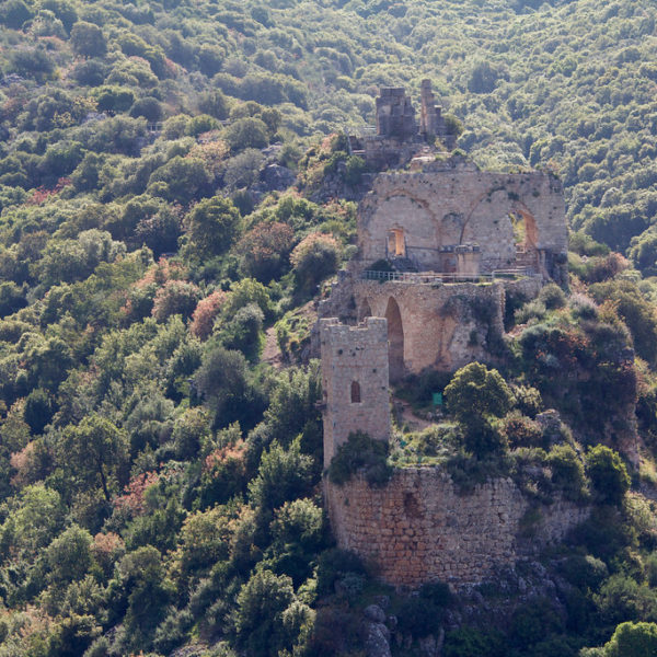
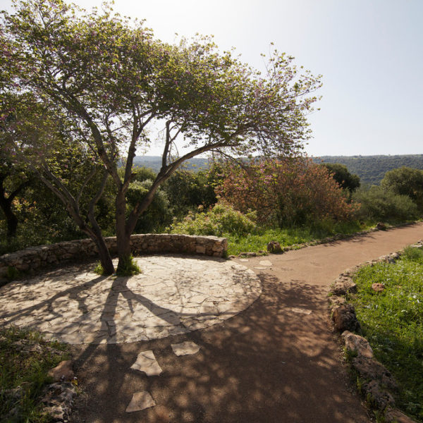
Back on route 899 the tour continues west. At the entrance to Moshav Granot it turns left and immediately left again to a gravel road. This wonderful road takes travelers to the Goren Park and from the moment it follows the Kziv River cliff, the wonderful landscapes of the river are revealed to travelers and the Israeli thicket paints everything green. A stop at the Olive Observation Point is recommended. Visitors are likely to observe some fallow-deer roaming free around the reservation. These have been brought here from Persia and re-introduced to nature in the Kziv River as well. The tour in the Park ends at the Montfort lookout reached by driving at a moderate speed on the road bound west. At the parking lot visitors may leave their vehicles and walk along the marked pathway about 250 meters to the observation terrace from where one can see the Montfort Castle in all its grandeur. The castle, established in the 13th century by the Teutonic Crusader Order, appears to be hanging from the beak of the extension that gave it its name “little horn” castle, or in Arabic “Kal’at el-Kurein”.
At Goren Park the Jewish National Fund prepared a huge camping area, with pathways and easy hiking trails. It is a wonderful place to open up a table under the oak trees and let the children frolic amidst the trees of the natural grove. On the way back travelers will drive on the winding asphalt road connecting the park and Moshav Avdon; beginning literally next to the park and ending on road 70.
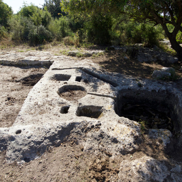
A Surprise Ending – the Crusader Sugar Factory
At the Avdon intersection alongside road 70, about 200 meters to the south, there is a Crusader factory for the production of sugar. This is a 12th century site that was reconstructed and renovated in recent years. Visitors can see here the remains of the aqueduct leading from Kziv River, the sugar cane crushing mill and the remains of the hall built on a foundation